Ok - I tried mailing in two different ways - both from the MRA Save As menu
1st using the save as gpx v1.1 (Route Track POI) which saved the file to my computer. I right click the file and choose send to ... email recipient. And send it to my smartphone, then open it with drive and send to the XT.
The second method is Save as Email (down at the bottom of the list). This gives a different screen which asks for the email address and the type of file you want to send. I chose the same again, v 1.1 and that sends it directly to the phone. This is a lot neater, but I found that the 2nd and 3rd routes I sent in this way took 'years' to arrive.
Both produced the same results in the XT. The route came through correctly as the original with the start and end and five shaping points.
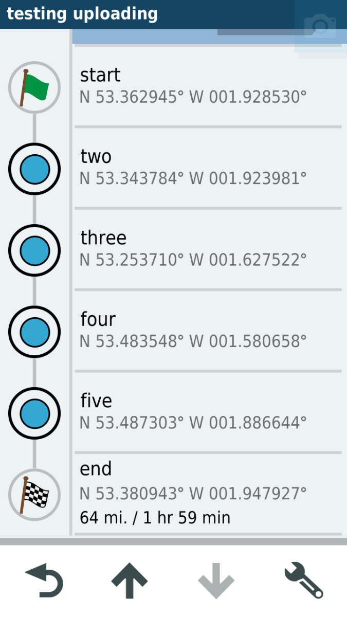
Here is the route list in the XT:
Note - all the following images are in their original resolution. Click the image to see a better quality.
- Paul 3.png (198.48 KiB) Viewed 2113 times
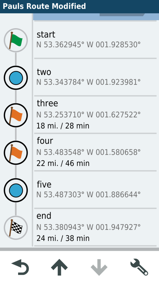
The shaping points are depicted as blue circles. Via points are shown as flags. The start has a green flag, the end has a chequered flag, inetrmediate via points have orange flags. No Via Points.
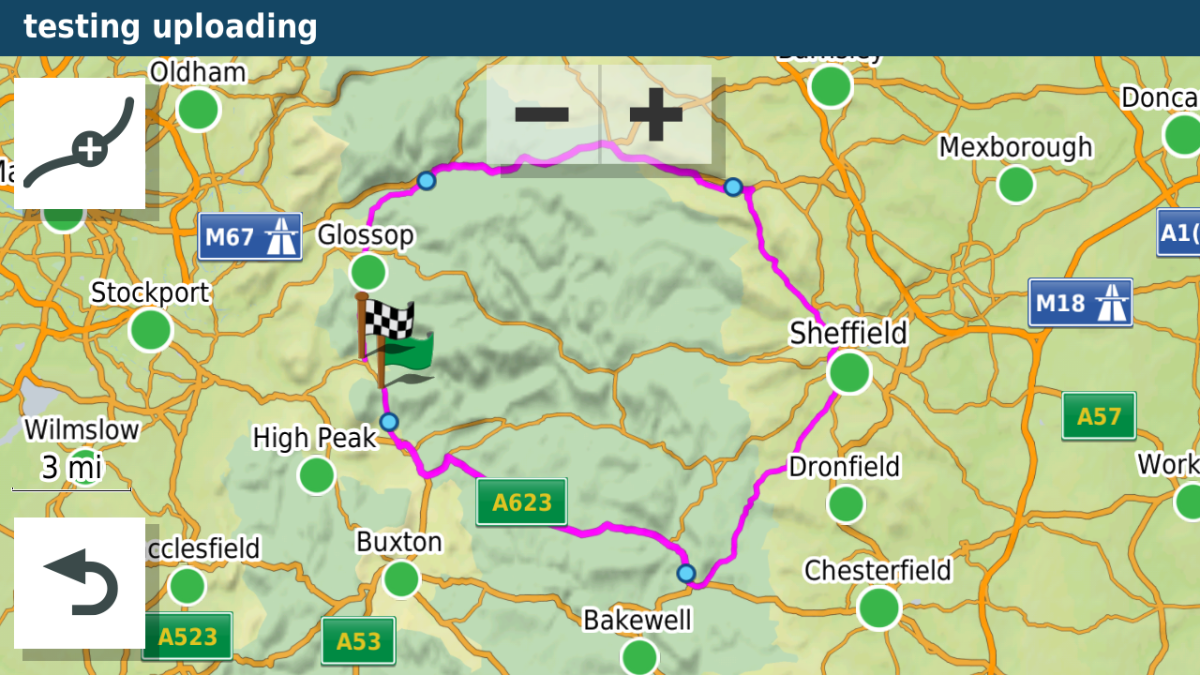
Here is the same route - as you sent on MRA shown on the XT preview map
- Paul 4.png (1.02 MiB) Viewed 2113 times
All route points accounted for - note the shaping points have smaller blue discs.
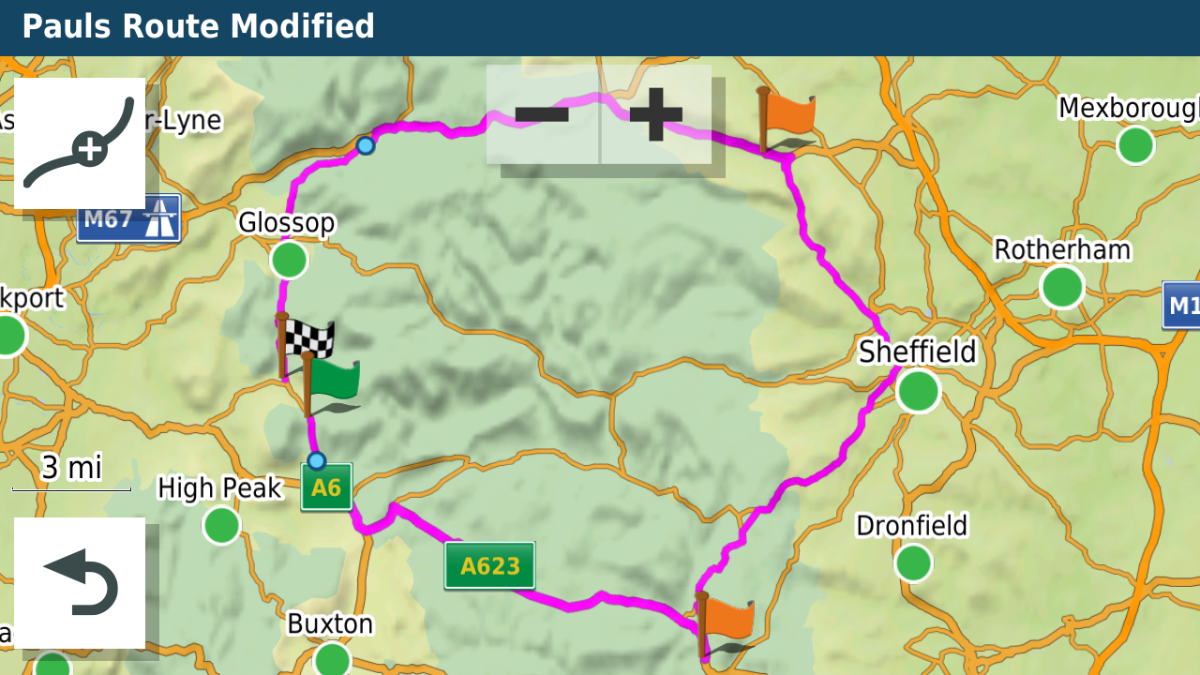
I changed points three and four to Via Points. Here are the results in the XT
- Paul 5.png (206.08 KiB) Viewed 2113 times
- Paul 7.png (1 MiB) Viewed 2113 times
Got to go. More to follow later.
...OK Back again
The facility to change the route points (MRA confusingly call them 'Waypoints' - which mean something completely different to Garmin ) was added relatively recently. I didn't touch MRA (or Tyre) for a long time, simply because it didn't make the distinction between Via and Shaping points. When they did introduce it, I bought a life membership.
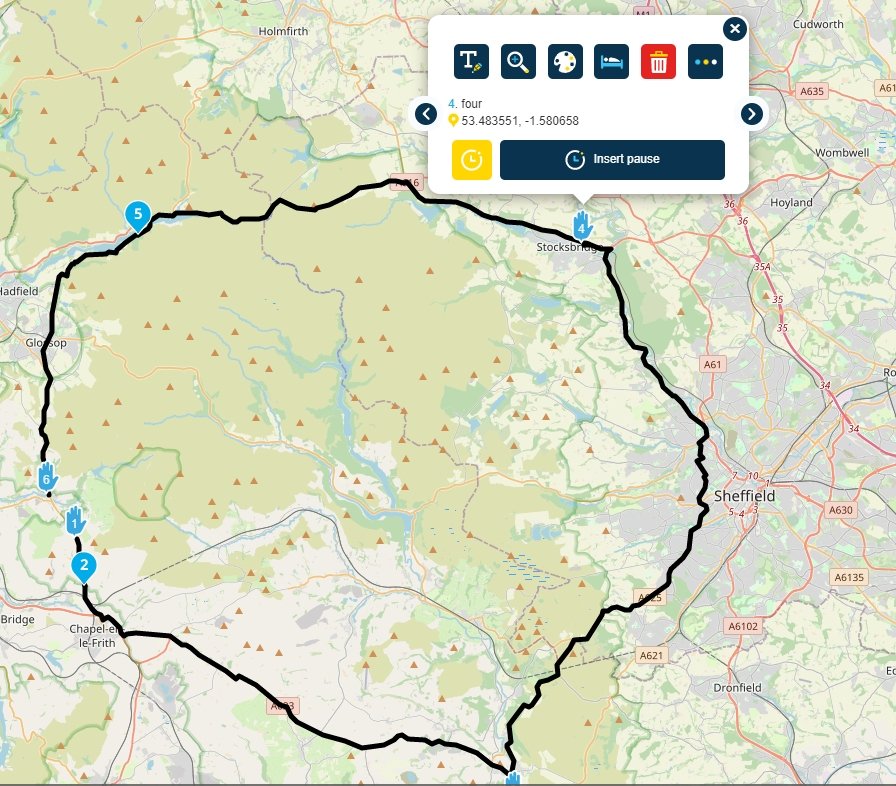
The facility isn't obvious. Here is you route just after I changed points three and four to be Via Points.
- Paul1.jpg (159.8 KiB) Viewed 2109 times
Note that three and four are now represented by a hand, and not a tear-drop.
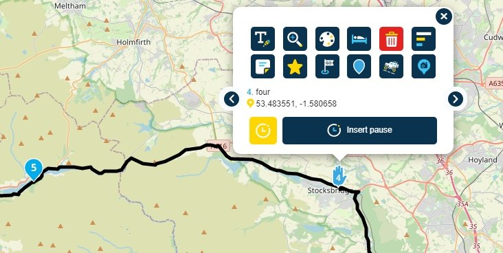
In order to change them you click on the tear drop, and a pop-up menu appears. Like the one above. Here I was about to change the hand back to a tear drop. There is no option ont he po-up menu, so you have to press the button with three dots - which displays a more detailed menu as shown below.
- Paul2.jpg (59.03 KiB) Viewed 2109 times
And now another exapnded menu appears. If the point you clicked was a hand, then you get a tear drop button - as in this example. If it was a tear drop, you get a hand.
So for the XT hand means a stopping place - a Via Point.
Tear drop means - well, a marker to force the orute to through this point - just a shaping point.
I've not been over Snake Pass since last year. The last time I tried was in March, and it was closed. I went trhough Castleton and back home via Strines - now there is a road that is much improved since I was last on it - as a 16 year old kid, I decided to go out for a cycle ride into Derbyshire. That was a long day... Steep hill, gravel and potholes is what I remember. Oh and rain.
