Page 1 of 1
Flying your Route in Google Earth
Posted: Thu Dec 02, 2021 8:34 pm
by jfheath
I've been using this feature for a while, but it was always a lot more complicated than this - or I was doing it wrong.
I've not seen any other documentation on it and I mentioned it to someone in another thread - so I hope this is useful.
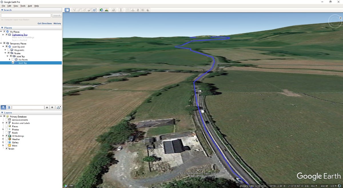
- Google Earth ScreenShot.jpg (132.96 KiB) Viewed 13986 times
Basically - create a route in basecamp.
Save the route or track as a KML file.
Load it into Google Earth
Automatically fly along your route through a 3D Landscape.
I've only done this with a PC. I assume something similar is possible with a Mac.
Re: Flying your Route in Google Earth
Posted: Fri Dec 03, 2021 7:48 am
by sussamb
That's how I do it now that the direct link between BaseCamp and Google Earth is broken.
Re: Flying your Route in Google Earth
Posted: Fri Dec 03, 2021 8:08 am
by kernowing
Thanks for this
@jfheath I'll give it a try

Re: Flying your Route in Google Earth
Posted: Fri Jun 20, 2025 8:20 pm
by lkraus
This is an old topic, but seems to be the best fit for this easy alternative to Google Earth flyovers.
Thanks to another forum, I just discovered
mapdirector.com.
Upload your .gpx (a track is best) and it will generate a 3D flyover with options for elevation overlays, addition of still pictures, etc in a variety of screen formats, and also allows .mp4 exports. It does not zoom in enough to assess road conditions, but could be very useful for an overview of a planned route or to add segments to a post-tour video.
It's also a lot of fun to play with...

Re: Flying your Route in Google Earth
Posted: Mon Jun 23, 2025 2:40 pm
by tombarrington
That might have been my post. We'll be using it as a preview to our next day's ride in the blog we share with family. Here's an example from eastern Oregon:
Re: Flying your Route in Google Earth
Posted: Thu Sep 04, 2025 8:35 am
by jfheath
That's a very nice alternative to the Google Earth version. @tombarrington and @lkraus
I should have said with the Google earth one, you can change the height and positon of the 'camera'. So you can get the high up view as well. I'm not sure about the moving dot though. I haven't played with it enough.
Thank you for posting.
Re: Flying your Route in Google Earth
Posted: Thu Sep 04, 2025 2:21 pm
by tombarrington
You have similar options in Mapdirector, almost too many. The developer is constantly refining the program which, for me, means I have to relearn some of it. Still, it's an interesting way to share a route.
Re: Flying your Route in Google Earth
Posted: Wed Feb 18, 2026 10:28 am
by BashStreetKid
The Google Earth flyover facility is still available almost direct from a BaseCamp route.
From memory, export the route from BaseCamp but in KML format (BaseCamp has the option to convert) then export to Desktop.
Open GE and import the KML route.
Away you go…
Very simple and straightforward.
I’ve been using it lately to view routes along my upcoming Moselle Valley region tour.
Re: Flying your Route in Google Earth
Posted: Wed Feb 18, 2026 3:34 pm
by tombarrington
Very nice, and easy to create from BaseCamp. It took a couple of tries but I was able to fly one of my routes. For my use case (preview of a route in our trip blog) I'll probably stick with Mapdirector as I can squeeze a 200 to 500 mile day into about 3 minutes of video.