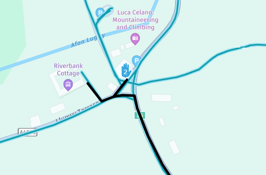
OK I've had a bit of a look at this and for the deviation at "Joe Browns" Shop this is a fault with the Here mapping used by Garmin if it is reported to HERE it should get fixed (Eventually).
This is what it looks like on my Basecamp mapping CN Europe 2027.10

- Screenshot 2026-05-05 105157.png (76.03 KiB) Viewed 338 times
If I use HERE maps on MyRoute app route planner for the same Junction it does this.
- Screenshot 2026-05-05 110817.png (62.6 KiB) Viewed 338 times
And if I use Open Street Mapping on MyRoute app it displays correctly.

- Screenshot 2026-05-05 111102.png (112.5 KiB) Viewed 338 times
I'm not sure what Satnav you are using but you could get round this by leaving your last waypoint a little before the Junction at the A4086 and putting instructions to stop at the shop in the "Notes" section of the Waypoint attributes. On XT models the notes will be read to you.

- Screenshot 2026-05-05 105550.png (31.95 KiB) Viewed 338 times
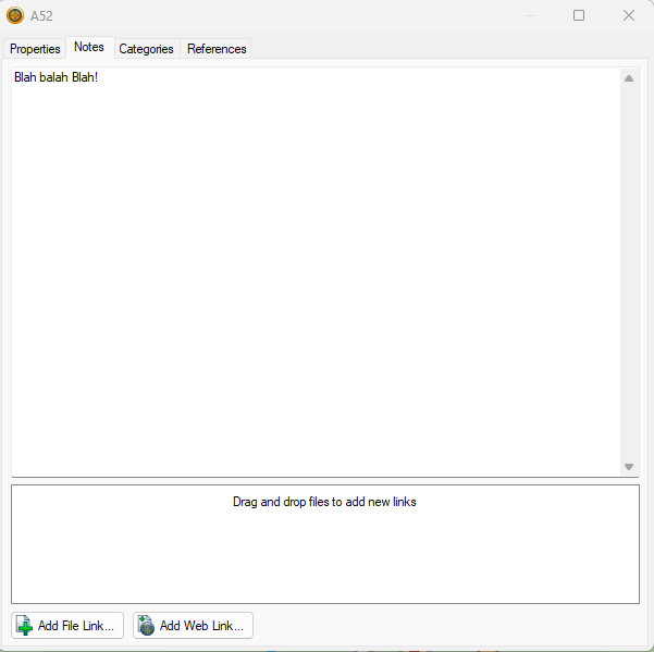
- Screenshot 2026-05-05 105744.png (20.67 KiB) Viewed 338 times
With regard to the Faster Time setting sending you down minor roads. There are two ways to fix this.
The best way is to scrutinise your route and fix deviations with shaping points on the roads you want to be on. Placing a shaping point every 3-5 miles pins the route and makes it more likely that everyone will end up following the same route if you are giving the GPX files for others to use. In this case I would also give them a "Track" of the route so that they can be sure that when they calculate the route on their own devices everything will match. To semi permanently stop Basecamp routing down little tracks you can also alter the parameters it uses to calculate "Faster Time". If you go to EDIT>Options on the menu and open Activity Profile you get this.
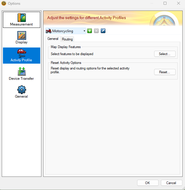
- Screenshot 2026-05-05 110400.png (68.72 KiB) Viewed 338 times
Go to Routing and scroll down to speed Customise

- Screenshot 2026-05-05 110534.png (83.28 KiB) Viewed 338 times
This will open the speed dialog for roads these are the defaults
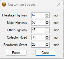
- Screenshot 2026-05-05 110628.png (11.42 KiB) Viewed 338 times
If you reduce the speeds on the lesser roads it will make Basecamp less likely to use these when you plan a route.
HOWEVER.
If you are plotting a route for several people with different devices their device settings may mess this up as may yours unless it can be set to perfectly match the Basecamp settings. So as stated above
1.plot the route and use plenty of shaping points to keep the routes on the roads you want to be on
2. Only use Via points for places you want to stop
3. Give everyone the route and the track to ensure the best chance of everyone going in the same direction.
Hope that helps.


