@jfheath. Thank you for the reply and your testing details, which are certainly helpful. Chasing answers during the changing evolution by Garmin must have added to your fun!
I have taken some time to digest what you shared. If I understand them correctly, your results seem to be consistent with what I have found. I too have seen that CEP does head to the Magenta route line, not the closest via or shaping point. The U-turn related effect you point out is interesting. I normally allow U-turns, as your suggest, although I’m not sure it matters for the simple case I’ve offered here.
Please allow me to take this discussion a bit deeper. The magenta route line is, of course, made up of route points. When CEP heads toward the route line, I think, more precisely, the software calculations would require heading to one or more of the specific points which define the route line. That is consistent with what I’ve seen and with the information I received from Garmin support. For purposes of the CEP calculations, I believe it does not matter what type of point. Via, shaping and hidden points are all equivalent route points to be considered in the calculations.
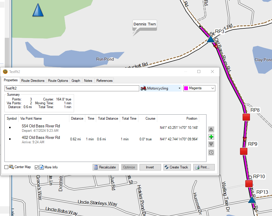
I have refined my previous example route slightly and added some additional detail for clarity.
As before, I specified just two points, the start and end, which, of course, are both via points. There are no shaping points.
- CEP2RouteDetail.png (166.63 KiB) Viewed 157 times
(As a side note, “Points: 3” in Basecamp’s Summary display is yet another curiosity I’d like to chase down sometime in the future.)
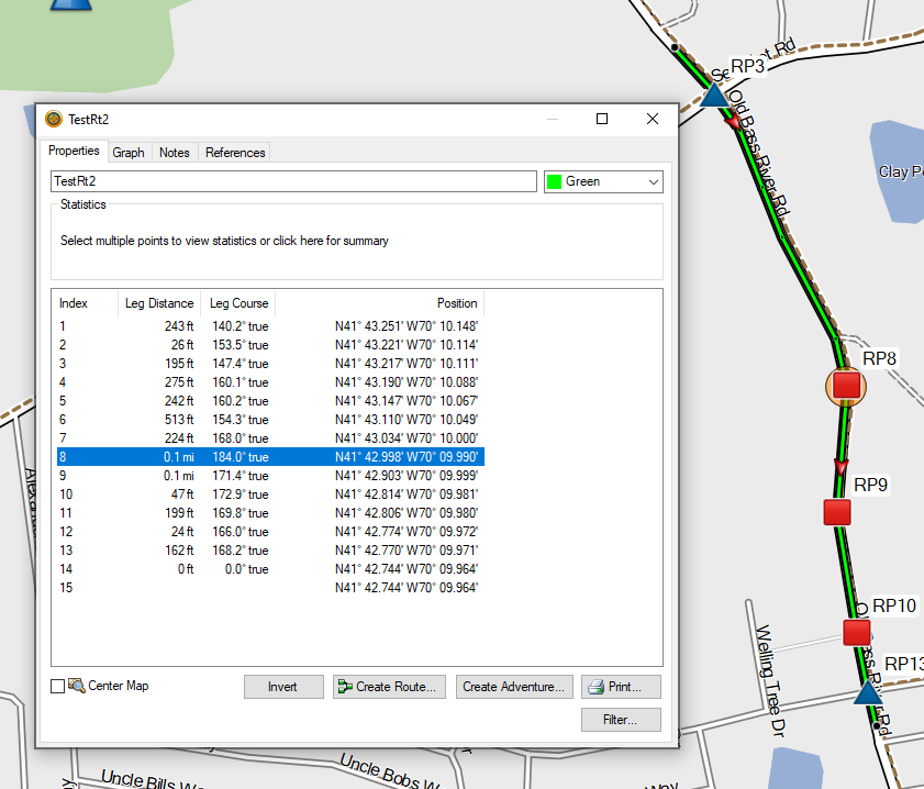
Converting the route to a track indicates 14 / 15 track points (the last two are the same location), which implies that number of route points, with all but two being “hidden” or “ghost” points.
- CEP2RoutePoints.png (137.43 KiB) Viewed 157 times
As you can see, I have marked and labeled some of the hidden route points for clarity.
I’ve noticed that the routing calculations appear to put a hidden route point at every intersection and every point where the road changes direction. Further below it will become clear why I point this out.
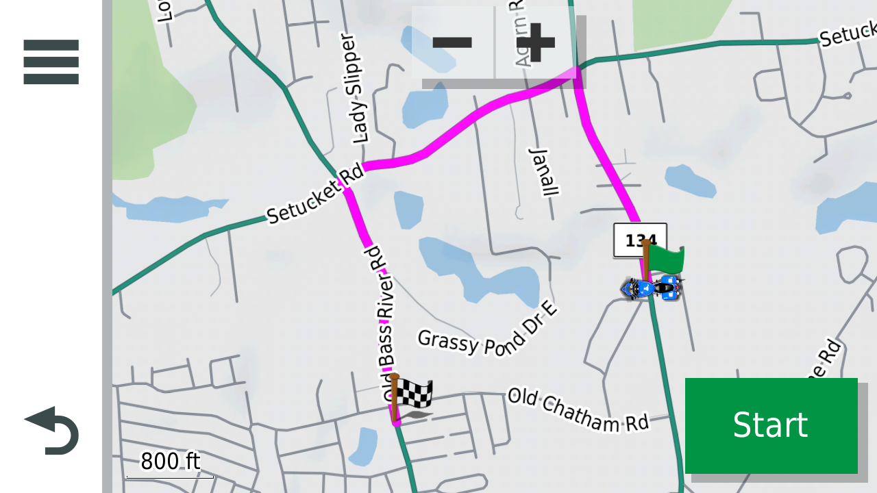
I have also marked the two off route locations where the motorcycle rider might start the CEP process (green circles A and B).
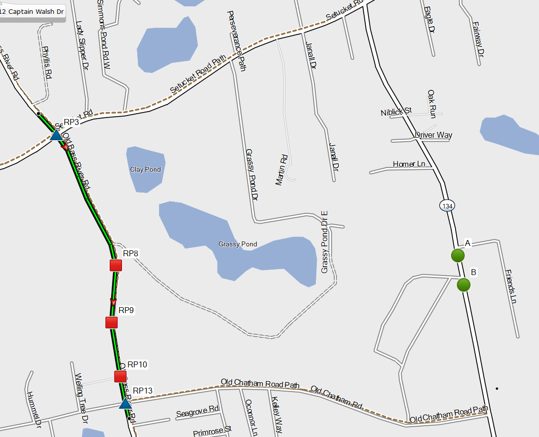
- CEP_2_Base.png (288.06 KiB) Viewed 157 times
From either A or B, there are only two [on road] locations where the motorcycle could join the route. Those are marked with the blue triangles at Route Points 3 and 13.
To the human eye (my eye at least), it appears that both A and B are closer to RP13 than to RP3, so I would expect CEP to go that way from either A or B.
As indicated in my previous post, CEP from B does route as expected, but CEP from A joins the route at RP3.
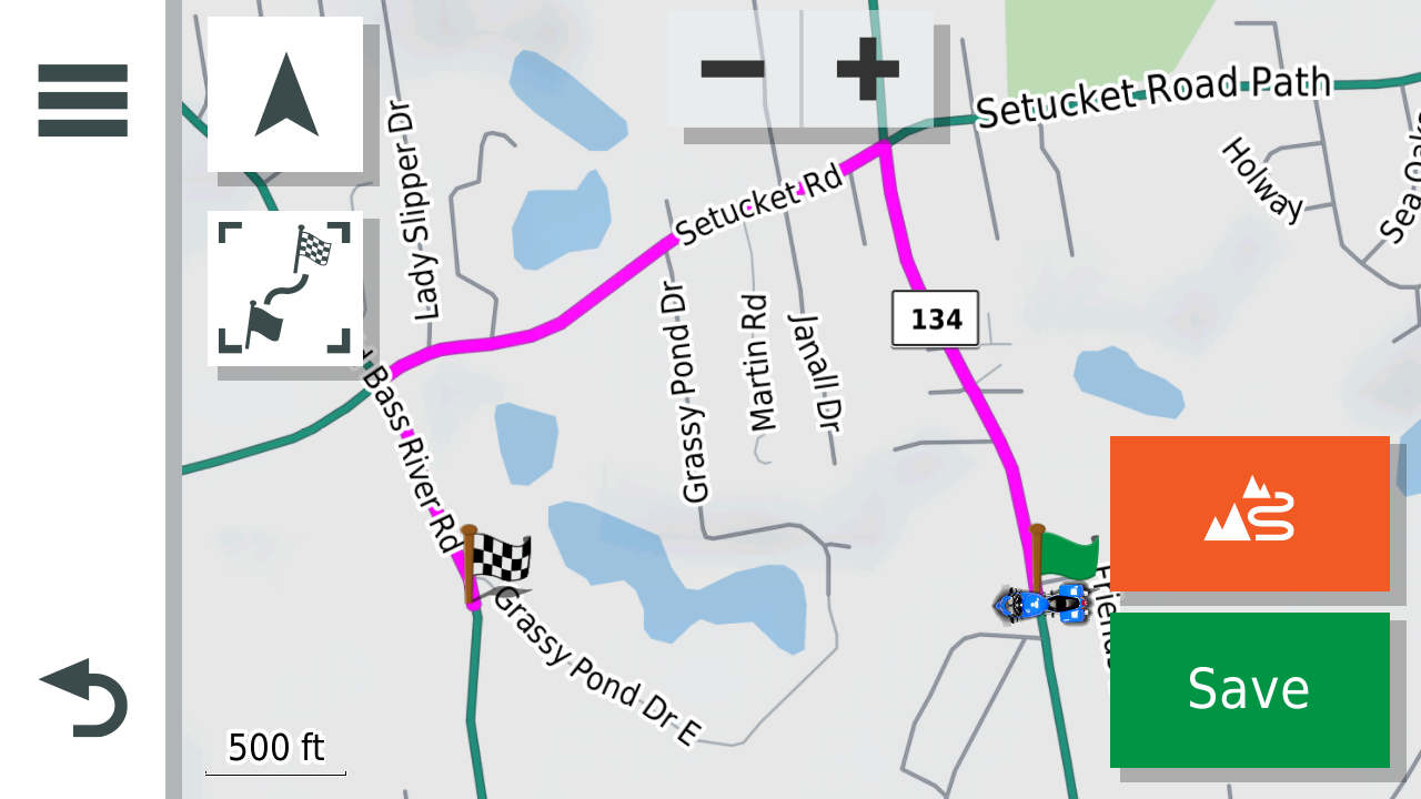
Do my eyes fail me? I am getting old! I checked and found that A is 1.1 miles from RP3 but just 1.0 mile from RP13 so my eye is correct, at least by distance over the road. As a further check, I created a route directly from A to RP13. The routing calculation on the zumo XT took the expected shorter route. I tried both Faster Time and Shorter Distance preferences. I routed from A to both RP13 and the end via point. In all cases, it took the expected shorter route.
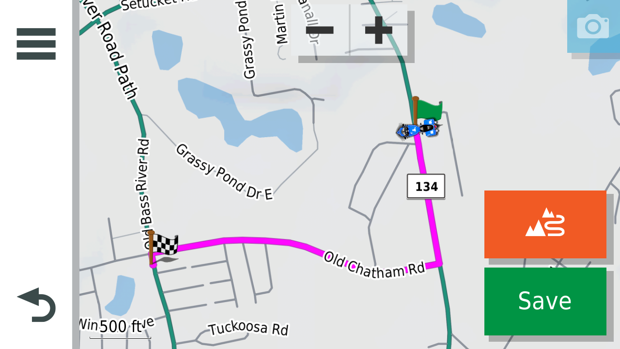
- Route_AtoEnd.png (376.61 KiB) Viewed 157 times
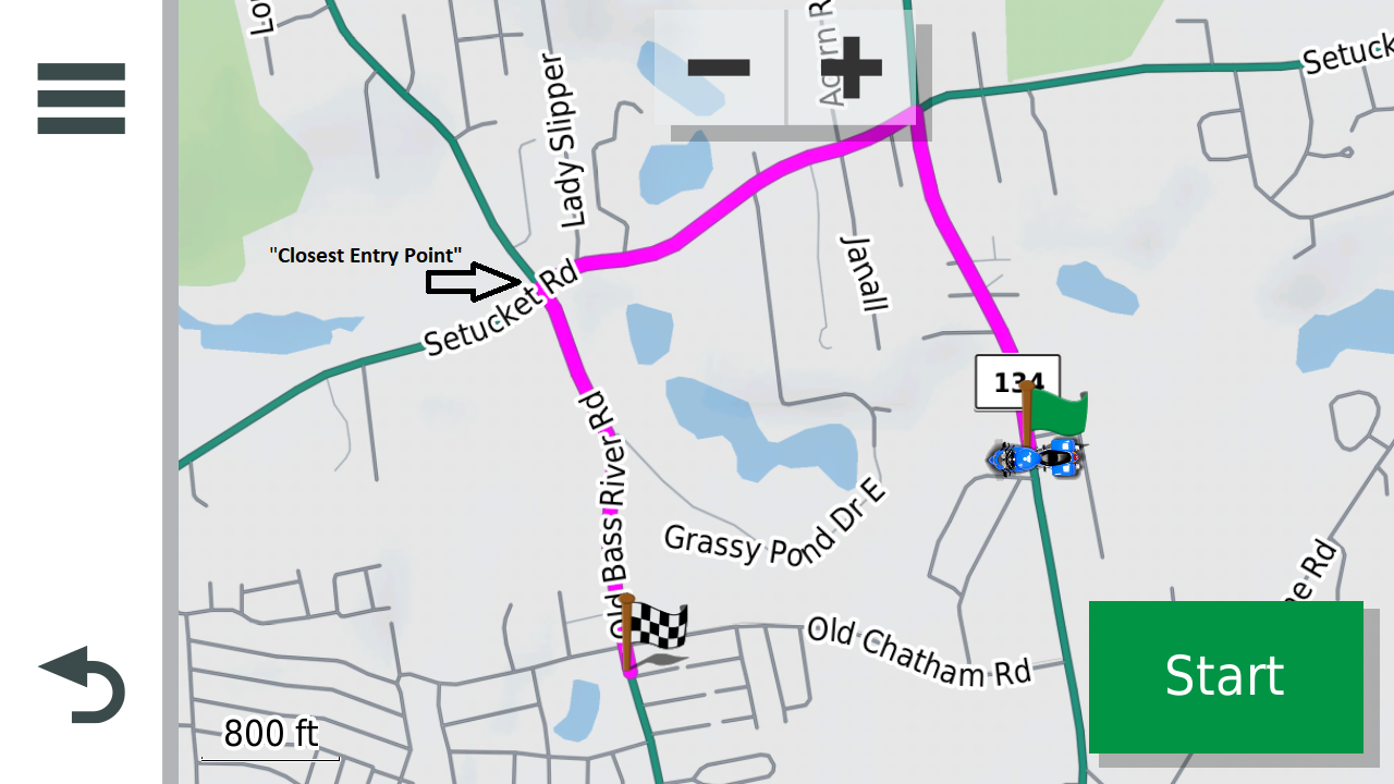
So why does CEP from A take the unexpected longer route?
- CEP2fromA.png (592.78 KiB) Viewed 157 times
According to my theory, it is because the closest route point to A is RP8 …
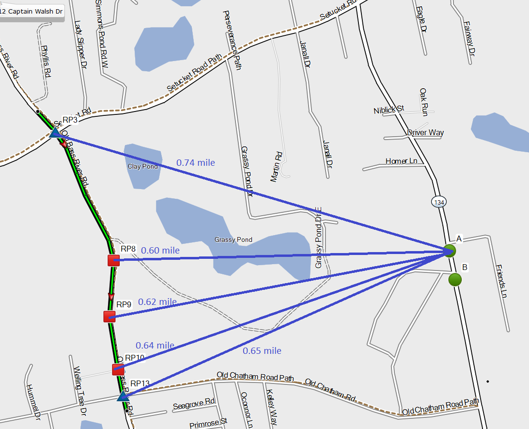
- CEP_2_DistanceA.png (293.6 KiB) Viewed 157 times
… and the shortest route from A to RP8 is via Setucket Road.
- RouteAtoRP8.png (422.33 KiB) Viewed 157 times
I’ll explain further.
I think, like many other terms, “Closest Entry Point” is a bit of a misnomer. Again, there are only two possible actual entry points here, RP3 and RP13.
From A, the “Closest Entry Point” is RP3 even though RP13 is closer by time, road distance and “as the crow flies”.
What I believe the zumo XT is doing is not unreasonable. It’s just a matter of terminology, and computing efficiency. At the start of the CEP process, the zumo only “knows” the planned route and the current location (A). It needs to calculate an additional route from A to the planned route, which really means from A to a point on the planned route. Which point on the planned route? The Closest Entry Point of course, but it can’t know which point that is without calculating the route. It’s a bit of a “catch 22”. It can’t even know which route points are possible entry points without calculating routes.
Calculating routes from A to each point on the planned route would be a lot of work – that is a lot of compute power and time. So, how does the zumo decide what route to calculate? A reasonable approach would be to start with the much faster calculation of straight line (as the crow flies) distances from A to each route point. Some of those distances are shown above in the CEP_2_DistanceA screenshot.
Using that approach, RP8 is the closet route point to A. This gives the software a destination for the additional route calculation. The route from A to RP8 can now be calculated. That route is shown above in the RouteAtoRP8 screenshot.
The final step is to merge the additional route to the planned route. Since route calculations put hidden points at intersections, it is easy to determine that the two routes intersect at RP3.
- CEP2fromA_CEP.png (595 KiB) Viewed 157 times
RP3 becomes the “Closest Entry Point” (even though RP13 is closer to A by every reasonable measure).
If this theory holds, then the “Closet Entry Point” is the point where two routes meet.
The first is the planned route.
The second is a route calculated from the current location to the closet point in the planned route.
Closest point here means, from the set of via, shaping or hidden points which specify the planned route, the point which is the shortest distance, as the crow flies, from the current location.
As you have pointed out, there does appear to be a flaw when the current location is in line with the planned route. I’ll share a thought on that separately.


